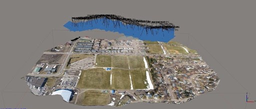
UNMANNED AERIAL VEHICLE MAPPING (UAV)
We Offer Services Using Unmanned Aerial Vehicle (Uav) For The Purpose Of Monitoring, Survellience, Observation And Topographic Mapping.
Unmanned Aerial Vehicle (UAV) :
- Does not need qualified pilot on board. The learning curve of operating UAV is faster than aircraft
- Can enter dangerous environments and hazards
- Reduces the risk of the aircraft operator
- Can stay in the air for up to 3 hours– performing a precise, repetitive visual scan of a region, day-after-day, night-after-night in complete darkness, under computer control
- Can be programmed to complete the mission autonomously, even if it lost contact with the ground control


READY TO MOVE YOUR BUSINESS FORWARD?
Contact Us NowAbout Us

AJH Surveyors Specialised In Satellite (Radar) Leak Detection, Underground Utility Mapping, Topography, Hydrography, Photogrammetry, Gnss, Gis Survey, Terrestrial Laser Scanning, Lidar, Unmanned Aerial Vehicle (Uav) Mapping And Land Development
Products/Services
Satellite (RADAR) Leak Detection
Underground Utility Detection Survey
Geographical Information System (GIS)
Light Detection And Ranging (LiDAR)
Land Development
Engineering Survey
Topographical Survey
Hydrographic Survey
Terrestrial Laser Scanning
Unmanned Aerial Vehicle Mapping (UAV)
Get In Touch
22-2-2A Jalan Medan PB2A, Medan PB 2,
Pusat Bandar Bangi,
43650 Bandar Baru Bangi,
Selangor Darul Ehsan.
ajhsurveyors77@gmail.com
03 8926 5677
03 8926 8677
