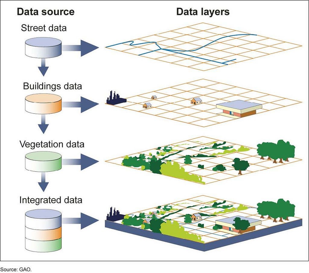
GEOGRAPHICAL INFORMATION SYSTEM (GIS)
We Are The Expert In Geographical Information System (GIS). AJH Surveyors Offers Geospatial Services Which Allow For The Visualisation Of Geographic Data.
Geographic Information System (GIS) include of the following services :
- GIS System Development and Implementation
- Digital Mapping and Data Acquisition
- Data Conversion and Migration
- Remote Sensing Services and Geospatial Data Provider Normalised Difference Vegetation Index (NDVI)


READY TO MOVE YOUR BUSINESS FORWARD?
Contact Us NowAbout Us

AJH Surveyors Specialised In Satellite (Radar) Leak Detection, Underground Utility Mapping, Topography, Hydrography, Photogrammetry, Gnss, Gis Survey, Terrestrial Laser Scanning, Lidar, Unmanned Aerial Vehicle (Uav) Mapping And Land Development
Products/Services
Satellite (RADAR) Leak Detection
Underground Utility Detection Survey
Geographical Information System (GIS)
Light Detection And Ranging (LiDAR)
Land Development
Engineering Survey
Topographical Survey
Hydrographic Survey
Terrestrial Laser Scanning
Unmanned Aerial Vehicle Mapping (UAV)
Get In Touch
22-2-2A Jalan Medan PB2A, Medan PB 2,
Pusat Bandar Bangi,
43650 Bandar Baru Bangi,
Selangor Darul Ehsan.
ajhsurveyors77@gmail.com
03 8926 5677
03 8926 8677
